Despite being swallowed up by Loughborough over forty years ago, Thorpe Acre still feels much like a small village, as some of its rural character has been preserved. These photos were taken between September and October 2020.
 |
| All Saints Church, Thorpe Acre with Dishley. |
 |
Built in the 19th century to replace the crumbling Dishley Church, the building had modern extensions erected in the 1960s as Loughborough grew around the village.
|
 |
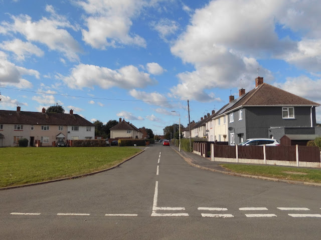
Thorpe Acre Road is the name of the road that runs through the old village.
|
 |
On the left is Chatsworth Road, one of the shortest roads in Loughborough. It connects Thorpe Acre Road to Sandringham and Buckingham Drives, part of housing developments near the village built in the 1970s.
|
 |
| Bungalows on Thorpe Acre Road, seen from Chatsworth Road. These were built in the 1970s. |
 |
| Thorpe Acre Road. |
 |
The new houses are the opening to Hawker Close, built in the late 2000s on the site of a dairy.
|
 |
Chatsworth Road. At the end, on the left is Buckingham Drive; on the right is Sandringham Drive. There are only six properties on Chatsworth Road.
|
 |
Stirling Avenue. This street runs between Thorpe Acre Road and Stirling Avenue.
|
 |
The churchyard looking towards the road.
|
 |
Looking towards the church building from Thorpe Acre Road.
|
 |
These shops were built in the 1950s to serve the new Knightthorpe council estate. These are effectively the village shops.
|
 |
The zebra crossing at Knightthorpe Road.
|
 |
Knightthorpe Road looking towards Epinal Way.
|
 |
Knightthorpe Road, looking towards Thorpe Hill. Thorpe Acre Green is a relatively recent addition to the village, as there were originally building on the site of the Green.
|
 |
The shops.
|
 |
| Wordsworth Road, looking away from the shops. |
 |
All Saints' Church, Thorpe Acre.
|
 |
This is, to my knowledge, currently the only branch of the Co-operative food stores in Loughborough. The building was formerly a pub, most recently called the Maltings but formerly The Gallant Knight. It was built on the site of Knightthorpe Hall c.1968.
|
 |
| Knightthorpe Road, looking towards Epinal Way. |
 |
The layout of the Co-op car park is, in my opinion, not very pedestrian friendly.
|
 |
| Kinchbus operate a few local bus routes; this is the 11/12 circular route, with buses running from Thorpe Acre to Shelthorpe via the town centre. In the suburbs they run a general loop, with the 11 and the 12 going in (roughly) opposite directions. This bus is one (and an odd one out, being three years older than the rest) of four ex-Trent Barton Optare Versas. These are the first new buses on the 11/12 since 2007. |
 |
Thorpe Acre Road, seen from Windsor Road. In the distance is an older public house, the Plough Inn. These days, the Plough Inn seems somewhat dormant, and as can be seen in the photograph, the sign, situated over a patch of whitewashed wall, has been removed.
|


Comments